United States Bridges 90 to 100 meters
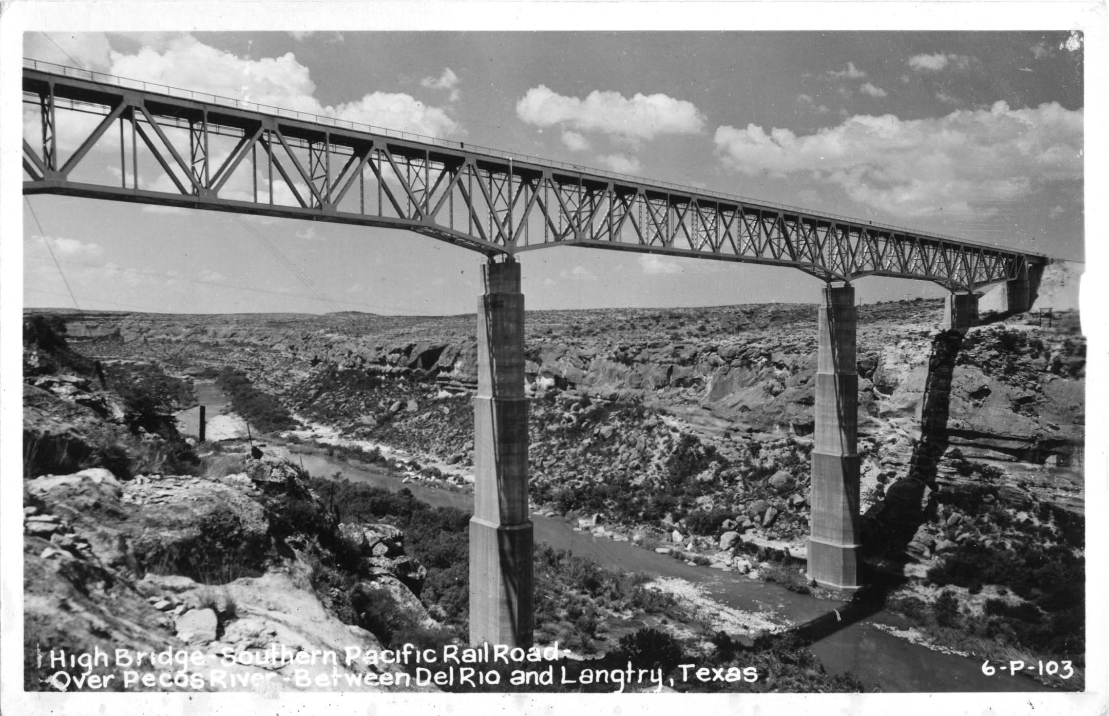
One of the highest railway bridges in the world when it was completed in 1892 near Comstock, Texas, the Pecos River railway bridge (99 meters high) was a spindly structure with a cantilevered central span of 185 feet (56 mtrs). The bridge was actually the second to cross the Pecos. The first was built in 1883 near the junction of the Pecos and Rio Grande Rivers. The route required a long, twisting descent into the Rio Grande canyon with deep cuts and 2 tunnels. A new high crossing over the river shaved 11 miles (18 kms) off the route. The highest bridge ever built in the state of Texas, the 1892 bridge was also the highest railway bridge in North America for at least 10 years. Owned by the Southern Pacific railroad, the 2,180 foot (664 mtr) trestle was fabricated by the famous Phoenix Bridge company in Pennsylvania and designed by Adolphus Bonzano. In 1910, a major reinforcement project was undertaken to strengthen the bridge, most significantly by the addition of a third centerline row of supports in-between the original two that make up the sides of each tower. In addition, 19 spans were removed on the west end and replaced with a fill embankment. The reconstruction required 1,100 tons of steel and 135,000 field rivets.
In 1949, the bridge was carefully taken apart with thousands of rivets removed by knocking off their heads with a pneumatic chipping hammer and then backing the rivet out of the hole. This was done so the sections could be sold to several highway departments around the country as well as a rumored sale to Guatemala where sections would be reused as a highway bridge.
Completed in 1944, the Pecos River railway bridge (99 meters high) was a replacement for the original 1892 trestle which was no longer worth maintaining despite reinforcing that was done in 1910 and 1929. Designed by the renowned firm of Modjeski and Masters, the new crossing is 440 feet (134 mtrs) downstream of the original bridge and consists of several deck truss spans along with a cantilever river span of 375 feet (114 mtrs) supported on two massive octagon shaped piers, one which reaches 257 feet (78 mtr) in height. When the Amistad dam was completed in 1969 across the Rio Grande, the backed up waters of the reservoir rose to a point where the bridge is only around 265 feet high (81 mtrs) during full reservoir. The route 90 Pecos River highway crossing is about 5 miles (8 kms) downstream of the railway bridge and is the highest road bridge in Texas.
Due for completion around 2015, the Pond Creek bridge (98 meters high) will be the highest bridge in the state of Kentucky, surpassing the nearly 100 year old High Bridge near High Bridge, Kentucky which carries two rail lines 308 feet (94 mtrs) above the Kentucky River.
Located 4 miles (6.5 kms) west of Elkhorn City, the Pond Creek bridge is part of a new Appalachian highway. After crossing Pond Creek, the highway will then cross the Russell River on a 200 foot (61 mtr) high bridge before heading into Virginia to connect with the Coalfields expressway where Virginia's highest bridge will soon be found 250 feet (76 mtrs) above Grassy Creek and due for completion in 2013.
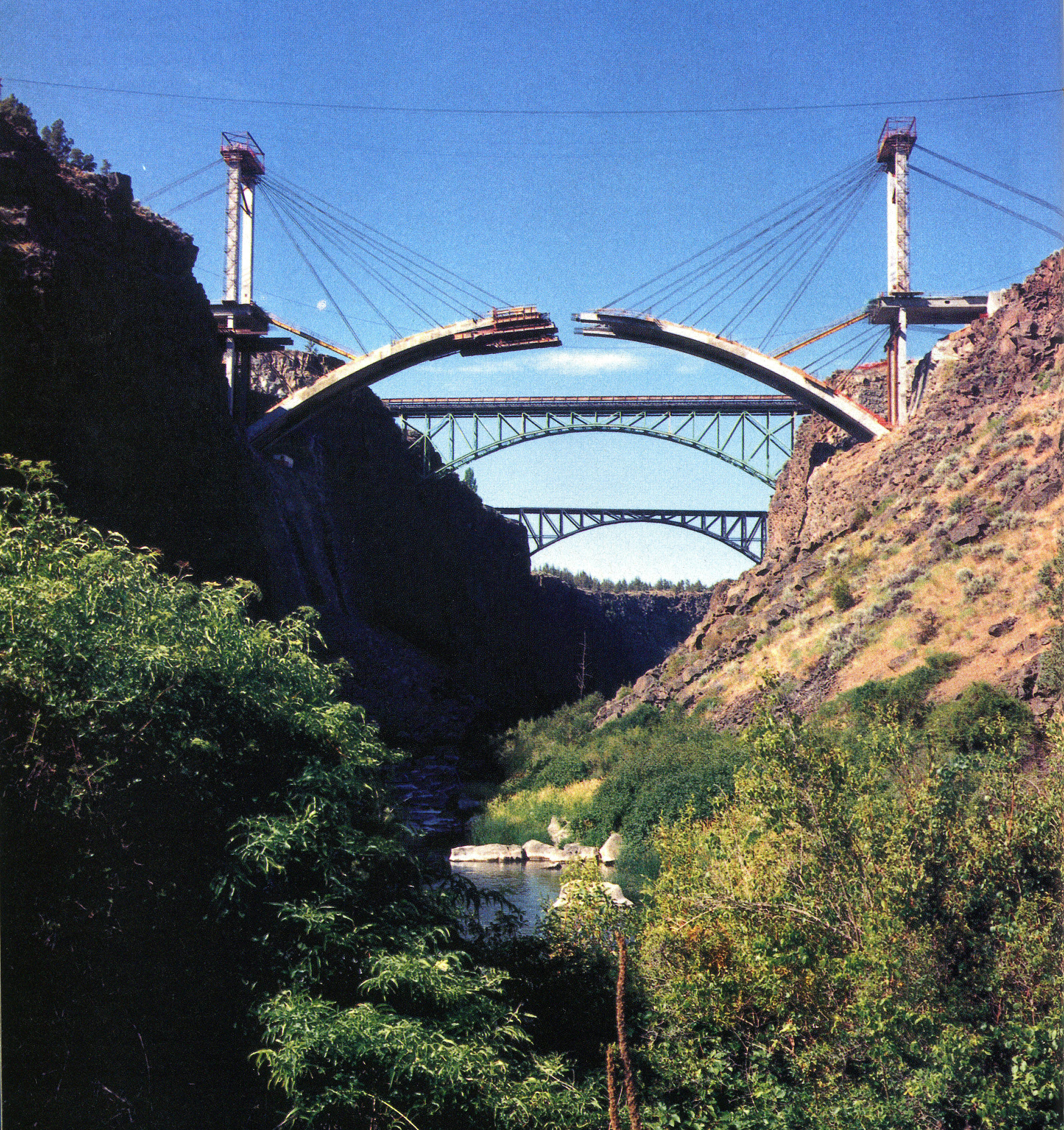
The first of what would eventually be 3 high bridges over the Crooked River, the Crooked River railway bridge (98 meters high) was completed in 1911 by the Oregon Trunk Railway, a subsidiary of the famous Spokane, Portland & Seattle Railway run by tycoon James Hill. The deep depth of the gorge required tiebacks to hold each half of the arch above the canyon as traveling cranes proceeded to build each spandrel further out into space. A long timber approach on the south side was eventually filled in later years.
Currently the highest bridge in the state of Kentucky, the 1911 High Bridge (94 meters high) railway crossing of the Kentucky river near High Bridge was originally built in 1877 as the first cantilever railroad bridge in North America. Designed by C. Shaler Smith, one of the most famous bridge engineers of his time, a cantilever was easier to construct since it eliminated falsework over the river that a normal truss would have required. Smith’s famous design was almost never built. John Roebling, fresh off his success as the engineer of the Covington to Cincinnati suspension bridge and the Niagara Falls railway suspension bridge, was contracted to build the bridge over the Kentucky River with a 1,200 foot (366 mtrs) long suspension span. Construction never proceeded beyond the two suspension towers before a decision was made to go with Smith’s triple span cantilever.
An increase in locomotive weight as well as age had taken their toll on the 3 decade old High Bridge structure and the Southern (now Norfolk Southern) railroad decided to build a new bridge around the older one. A descending grade into the Kentucky River valley was also eliminated by constructing a new bridge 33 feet (10 mtrs) higher than the original 275 foot (84 mtr) high cantilever. Another advantage of raising the bridge was the ability to build over the older structure, allowing rail traffic to continue uninterrupted throughout construction. The great bridge engineer Gustav Lindenthal designed a deck truss approximately 70 feet (21 mtrs) deep that was built with the same configuration of the three 375 foot (114 mtr) spans as the original 1877 bridge using the same bulky, oval shaped masonry foundations. Roebling’s towers survived the bridge changeover but were finally removed in 1929 when the bridge was double tracked. Despite the loss of the historic one-of-a-kind cantilever spans, the current bridge is still an impressive structure with unusual lattice truss pier supports that are unlike those on any other North American bridge.
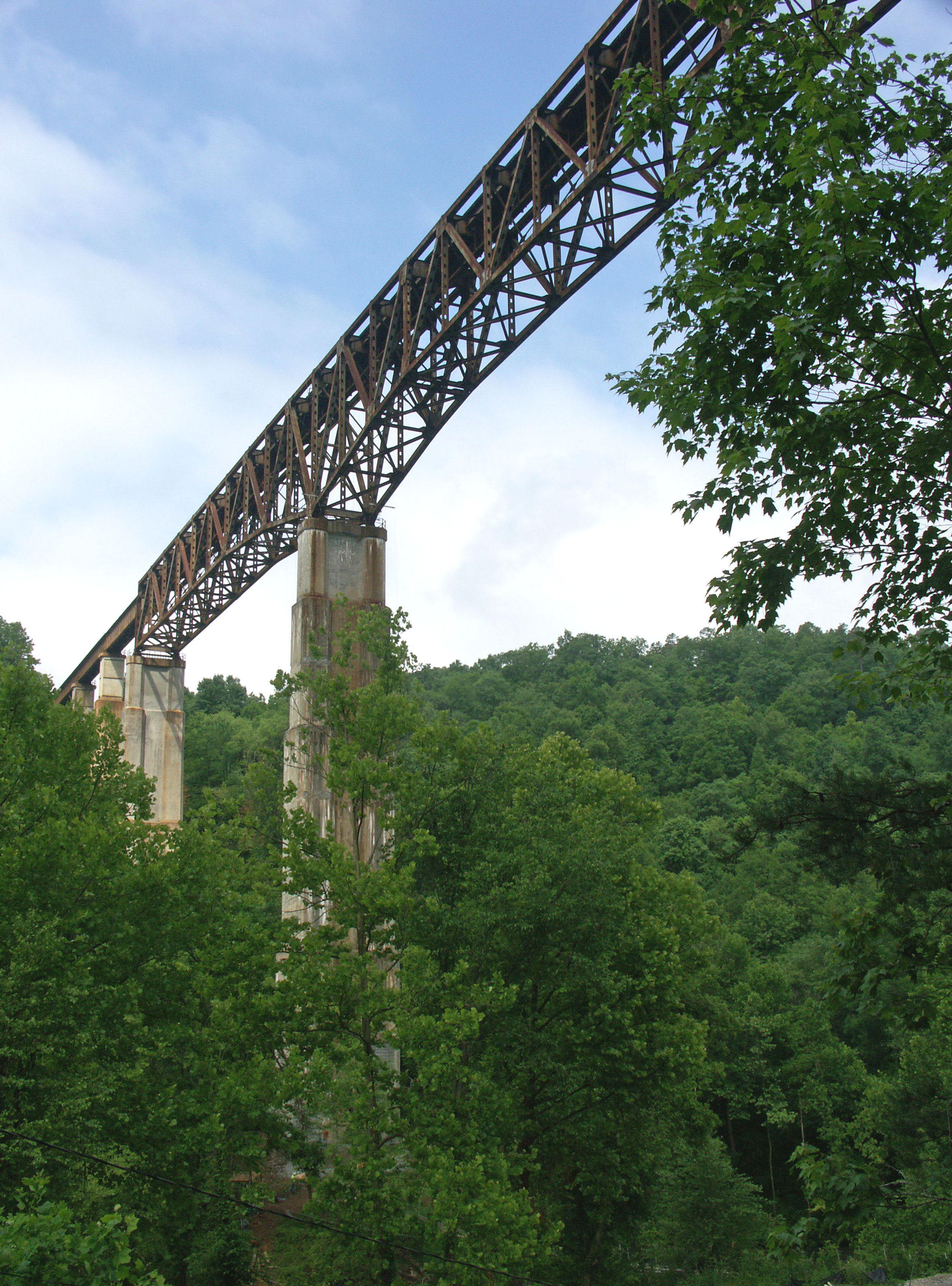
The highest bridge in the state of Tennessee, the New River railroad bridge (94 meters high) was constructed in 1963 as part of a realignment of Cincinnati Southern’s famous “rathole” line. Named after a concentration of tunnels between Danville, Kentucky and Oakdale, Tennessee, the route had gone through many changes over the years that continued to reduce the number of tunnels. In 1963, a major reconstruction of bores, cuts, fills and realignments finally ended the tortuous “rathole” forever. Eliminating the steep grade into the New River valley (Tennessee’s New River, not West Virginia’s) was also a part of the 1963 project and so a high bridge was built over the New River. Resting on two hollow concrete piers 392 feet (119 mtrs) apart is a central 3-span cantilever. Largely hidden by foliage, the bridge is located just a mile northwest of route 27 / 29 south of Helenwood, Tennessee. Note the older abandoned truss bridge just east of the highway as you cross the river.
The highest railway bridge in the world at the time of it’s completion in 1882, the Kinzua Viaduct (92 meters high) was also the highest bridge of any kind in North America for 10 years until the Pecos River railway bridge opened in 1892. Among all bridges in the world, it was third after the Charles Albert suspension bridge and the 354 foot (108 mtr) high Pont Chatelet stone arch bridge in France. Kinzua would lose its title as the highest railway bridge two years later when the Garabit Viaduct opened in France.
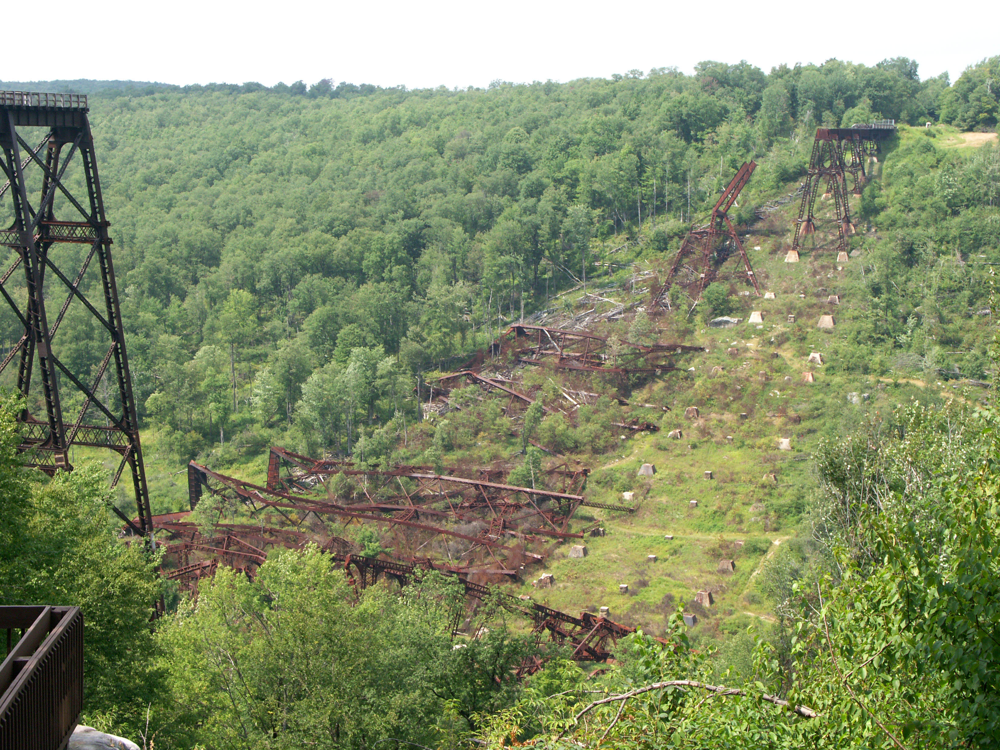
Constructed for a branch line of the New York, Lake Erie and Western Railway near Mt. Jewett, Pennsylvania, the bridge consisted of 20 towers, the tallest which reached 278 feet (85 mtrs) from the top of the foundation to the underside of the girder. These towers were 103 feet (31 mtrs) wide at the base. The original 1882 viaduct was a spindly structure with slender beams for the vertical and horizontal members and nothing but steel rods for diagonal bracing. By the late 1800s, the bridge had become unsuitable for heavier locomotives and in 1900, the entire structure was rebuilt using the original foundations. The new structure emulated the span arrangement of the old but with redesigned towers that only used diagonal cross members on the outside bents. The transverse connections within the towers did not have ‘X’ braced cross members as was the norm on any trestle of the day. Instead, a series of curved brackets were added to the corners of each connection to strengthen the structure and reduce movements from the wind. Some engineers of the time were critical of the design which went against the common logic that large triangular connections and trussing were a tried and true form for keeping any structure stable - especially a railway trestle as tall as Kinzua. The design created an unusual photo opportunity as a trapezoidal ‘tunnel’ effect formed inside the structure from the many repetitive openings within each tower.
The bridge was last used for regular train service in 1959. In 1987 the bridge was put back into service again when the Knox and Kane Railroad operated sightseeing trips across the bridge from Kane, Pennsylvania. In 2002 the bridge was closed for repairs largely related to rusty and inadequate bolt connections between the foundation and the bases of the towers. On July 21, 2003, the Kinzua bridge was hit by a powerful tornado that crossed right over the center of the bridge, knocking down the highest towers along with thousands of surrounding trees. With the cost to rebuild it prohibitive, a decision was made to preserve it in its current form with a plan to stabilize the giant towers where they fell. Despite the irony that the bridge had been closed just a year before to begin stabilizing it from potentially destructive winds, the complete flattening of large trees everywhere around the bridge is a testament to the power of the tornado and the likelihood that any trestle in that location would have been doomed to the same fate as the one that befell the great Kinzua viaduct.
Plans are currently underway to repair the remaining intact towers and allow pedestrians to walk to the end of the south approach where a glass bottomed platform may be built some 220 feet (67 mtrs) above the ground.
One of the more remote bridges in the United States, the Grandad bridge (92 meters high) is located about 50 miles (80 km) upstream of the 717 foot (219 mtr) high Dworshak Dam, one of the highest concrete dams in North America. Located near Orofino, Idaho, the dam was built in 1971 over the North Fork of the Clearwater River, a waterway that eventually empties into the Snake River at the border of Idaho and Washington states. During full reservoir, the Grandad bridge deck is only about 75 feet (23 mtrs) above the lake. During periods of drought, the water can drop as much as 200 feet (61 mtrs). Since the dam was completed, the level below the Grandad has never dropped to the original river elevation.
Much closer to the dam is the Dent bridge, a suspension span that is 500 feet (152 mtrs) above the bottom of the lake. Like Grandad, the bridge piers are usually submerged under the deep waters of the Dworshak reservoir.
Upon its completion in 2012, the Galena Creek bridge (91 meters high) became the second longest concrete arch bridge in North America, exceeded only by the Pat Tillman-Mike O’Callaghan Memorial bridge that opened in 2010 over the Colorado River near Hoover Dam in Nevada.
Beset by major construction delays relating to the construction of the main span, Galena consists of twin box beam concrete arches 689 feet (210 mtrs) long, each supporting 3 lanes of traffic along I-580 south of Reno, Nevada. Construction on Galena Creek initially started back in 2005 on the approach span piers with Edward Kraemer and Sons Inc. as the contractor. Work was then halted in 2006 over a contract dispute with the Nevada Department of Transportation. The contractor was worried that the main arch span could collapse during construction from high winds. The two sides disagreed and decided to part ways. It was not until 2007 that a new contractor - C.C. Myers of California - was brought in to take over.
The solution was simple enough. Instead of constructing the arch outward over the canyon in segments by the stayed cantilever method or by constructing wind prone falsework 300 feet (91 mtrs) high, the Galena creek valley would be filled halfway up, creating a giant rock embankment where a much lower and more solid falsework 150 feet (46 mtrs) high could be built on flat ground from one end of the arch to the other. Once the bridge was completed, the embankment was completely removed right down to the original creek bed, 300 feet (91 mtrs) below the road deck.
The pros and cons of such a construction method are debatable. Hundreds of large concrete arch bridges have been built around the world across deep canyons using the cantilever method with little problems and no know examples of a wind driven collapse. Was there really no way to safely tie down the two arch halves with steel cables or through the use of large temporary piers? The Chinese have a method that would have worked at Galena. The two halves of the bridge are built separately on falsework constructed just above ground on the hillsides at the edge of the canyon. Once completed, each side is then rotated horizontally outward over the river in one delicate maneuver (on a day when there is no wind) and then connected at the crown. The central bearing on top of each foundation consists of a pair of closely fitted concave spherical sections approximately 12 feet (3.6 mtrs) in diameter. Teflon flakes between the bearings keep rotational friction to a minimum. A massive water tank on the back of the counter weighting pier assists in finding an accurate center of gravity as well as preventing the system from overturning. Once the two halves of the arch are closed at the crown, the rotatable foundations are entombed in tons of concrete.
The first road bridge to be built across the Crooked River gorge, the Crooked River High bridge (90 meters high) is the second of what would eventually be 3 bridges to leap across the deep chasm. Located just east of the 1911 railway bridge, the 1926 steel arch was designed by Oregon’s great bridge engineer Conde B. McCullough. A steel truss-arch with a main span of 330 feet (101 mtrs), the narrow 2-lane bridge was finally bypassed by a concrete arch in 2000. At the same time, McCullough’s bridge was closed to traffic and turned into a pedestrian bridge. It is the second highest road bridge in the U.S. to be converted into a pedestrian bridge. The Navajo bridge in Arizona is the highest.
Officially known as the Rex T. Barber Veterans Memorial bridge (90 meters high), the 3rd crossing of the Crooked River is a 4-lane concrete arch that reflects the two earlier bridges constructed in 1911 and 1926. The arch was constructed using stays from two towers 102 feet (31 mtrs) high on each side of the gorge with a casting traveler that placed the 15 arch sections. In a Civil Engineering magazine article from January of 2001, the aesthetic choices of the arch design were described. “The visual profile of the new bridge was a primary design consideration because the structure frames the view of the gorge from the vantage point of McCullough’s bridge. Therefore, designers opted for the shallower profile of a deck-stiffened arch, as opposed to an independent arch, to reduce the visual mass beneath the deck. The Oregon Department of Transportation also later directed that the six supporting spandrels be revised from a wall spandrel configuration to an open column design to further improve views”.
The highest bridge in the state of Alaska, the Hurricane Gulch railroad bridge (90 meters high) is a steel truss-arch that was built in 1921 on the famous Alaska Railroad. Nearly 500 miles (805 km) long, the line extends from Seward at the Gulf of Alaska to Fairbanks in the north. There are many rail tours offered throughout the summer and include spectacular views from domed passenger cars. The bridge is located approximately 35 miles (56 kms) south of Cantwell, Alaska. Located a short distance from the rail crossing is the route 3 Hurricane Gulch road bridge - the state’s second highest at 260 feet (79 mtrs). You can read more about the Alaska railroad here: http://en.wikipedia.org/wiki/Alaska_Railroad
One of the highest prestressed concrete beam bridges in the United States, the Veterans Memorial Centennial bridge (90 meters high) is a simple but elegant 4-span structure with two central spans of 520 feet (158 mtrs). Located in northern Idaho, the bridge carries I-90 over Bennett Creek and is sometimes referred to as the Bennett Bay bridge which is located on nearby Lake Coeur d'Alene.
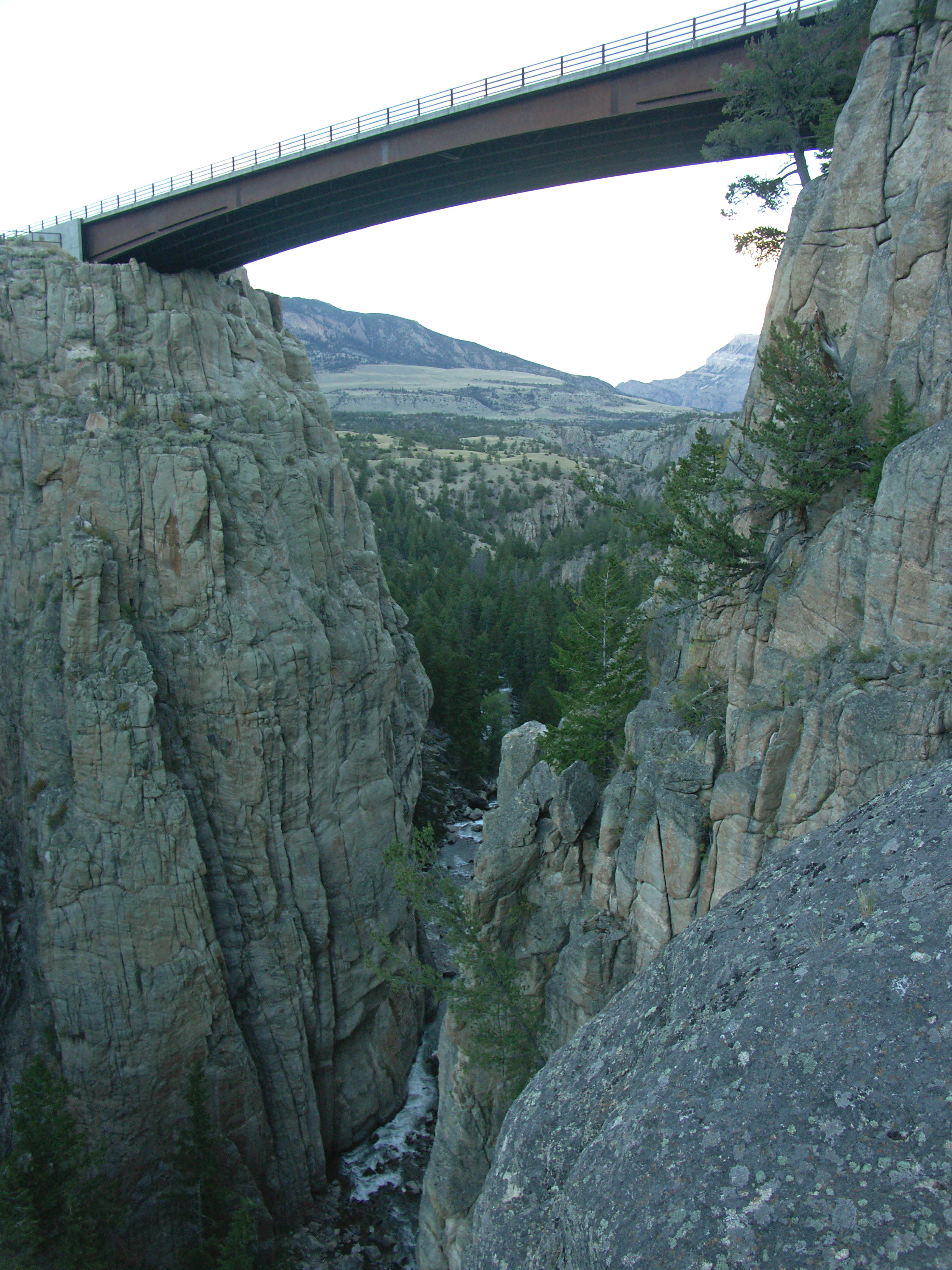
A simple one-span concrete beam bridge, the Sunlight Creek bridge (87 meters high) is located over a canyon so narrow and deep that the name is almost an oxymoron - sunlight rarely reaches the creek as it passes underneath the bridge. The highest bridge in the state of Wyoming, Sunlight Creek is located along the Chief Joseph Scenic highway route 296 that was completed in the mid-1980s as a shortcut between routes 120 and 212.
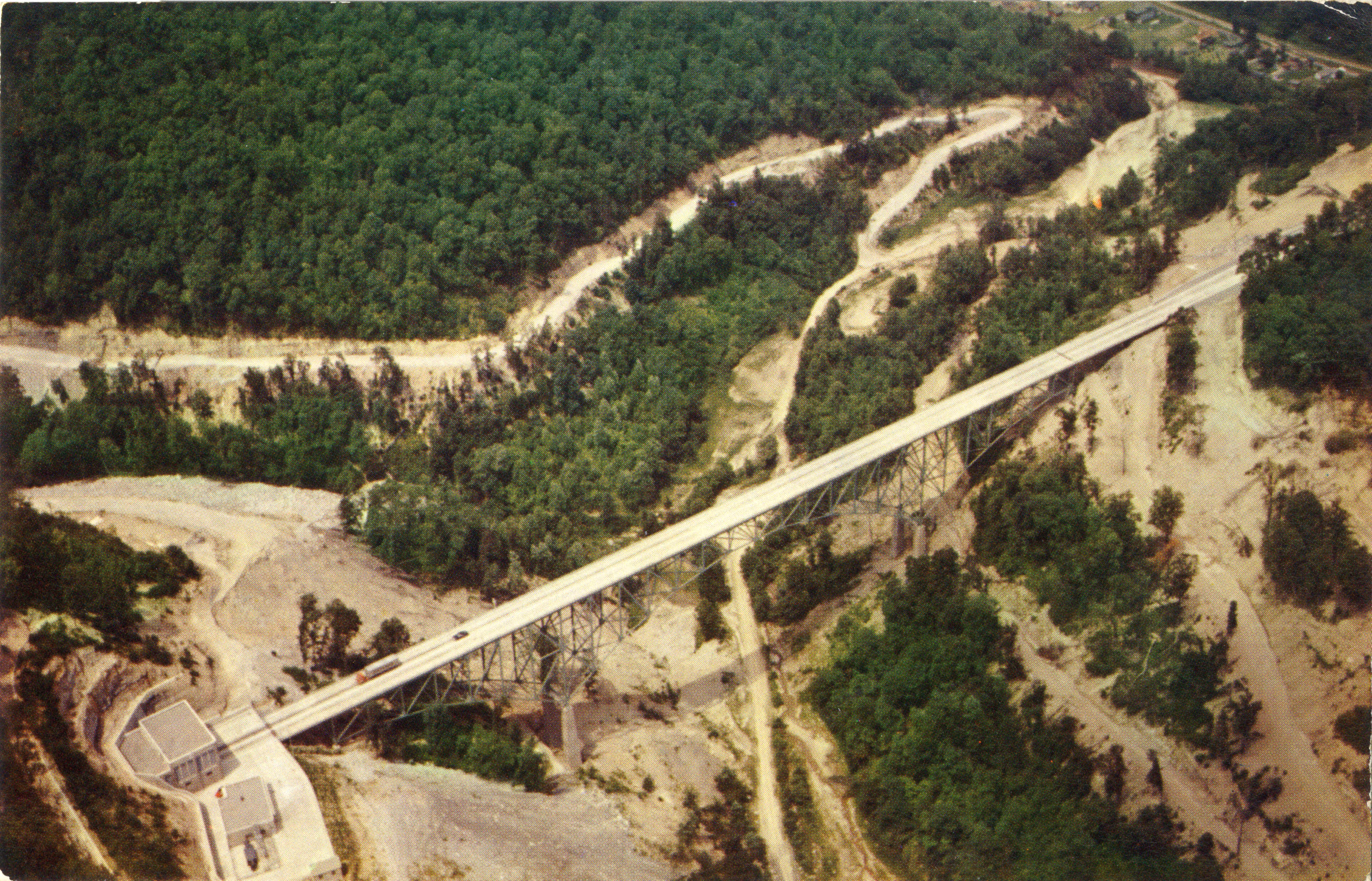
The highest defunct bridge in the United States never to be replaced, the Bender bridge (87 meters high) was a truss-arch built in 1954 along the West Virginia Turnpike, also known as I-77, that stretches from Charleston to Princeton. Still the only toll road in the state, the original highway had only 2 lanes along with numerous curves that were so tight, accidents and death were a common occurrence. Construction finally began in 1979 (a year almost 30 people were killed in accidents) to turn it into a safer 4-lane undivided highway. The last part of the project was the 1987 bypassing of the Memorial tunnel, the only underground stretch on the entire 88 mile (142 km) highway. The east end of the tunnel led directly onto the Bender bridge and across Fourmile Fork. A huge cut was made to the north of the tunnel while a huge fill more than 300 feet (91 mtrs) high was made over Fourmile Fork Creek with a culvert running under it. The wide slope of the fill covered most of the Bender bridge’s concrete piers. The bridge was no longer needed and was removed in 1987. The tunnel remained and is used today by firefighters and rescue personnel to practice emergency scenarios. The bridge was named for U.S. Army Sergeant Stanley Bender who won the Medal of Honor for taking out two German machine gun emplacements in 1944 during World War II.
Today the only major bridges on the WV turnpike are the 246 foot (75 mtr) high CH Carlton Memorial bridges over the Bluestone River which include the original 1954 truss arch and its near twin that was built parallel to it in 1979.
The tallest of many large trestles on Idaho’s now abandoned Camas Prairie Railroad, the steel Lawyers Canyon trestle (85 meters high) is unusual as the others are all made of timber. There are several subdivisions of the Camas Prairie but none has as many big trestles as the second sub between Spaulding and Grangeville. 5 of the world’s 20 known timber bridges over 100 feet (30 mtrs) high are on this stretch of railway including the Half Moon and Cold Spring trestles - the second and third highest timber railway trestles remaining in the world! Originally owned by Union Pacific and Burlington Northern Santa Fe, the railroad was sold to the independent Camas Prairie Rail Net in 1997. In 2002 it was sold again to the BG & CM or Bountiful Grain and Craig Mountain Railroad. Around 2003, a section of trestle-less tracks between Cottonwood and Grangeville were removed. A special tour train last went over the line in 2006. Currently, 52 miles (84 kms) of the original 66.5 miles (107 kms) are still in place. Will trains ever pass over these great trestles again? Only time will tell.
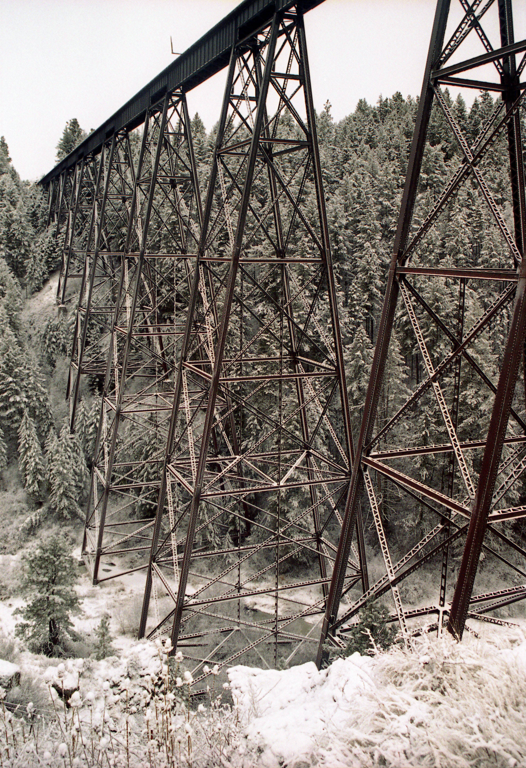
The crossing over Lawyers Canyon consists of 5 intermediate girder spans of 100 feet (30 mtrs) along with several smaller spans supported on twelve 40 foot (12 mtrs) long towers. The tallest trestle tower rises the full height of the bridge from creek to rail. This is currently the highest steel trestle tower left in the United States and the 4th highest ever built in North America after the Lethbridge Viaduct in Canada, the original Pecos River bridge in Texas (replaced in 1949 with a concrete pier structure) and the Kinzua Viaduct in Pennsylvania (mostly destroyed in 2003). California and Mexico have several railway bridges with higher piers but all are made of concrete. The two piers on the famous High bridge in Kentucky are steel but some may question whether they are true trestle towers.
The nearby highway bridge across Lawyers Canyon is also worth checking out. A simple steel girder bridge with two main spans of 265 feet (81 mtrs), the deck of the bridge stands 205 feet (62 mtrs) above the creek.
Lost in the mountains of northeastern West Virginia, the 4-lane Clifford Hollow bridge (85 meters high) is located along the still incomplete east-west highway called corridor H that is roughly following along the older route 55. The 6-span steel girder bridge has 4 central spans of 276 feet (84 mtrs) and two end spans of 210 feet (64 mtrs). Clifford Hollow bridge is located 5 miles (8 kms) east of Moorefield, West Virginia. If you travel further east past Baker, corridor H continues with high bridges over the Lost River including the highest, Lost River #2 which is 205 feet (62 mtrs) high.
