Difference between revisions of "Maoguanhe Bridge G56"
(Created page with "<div style="font-size: 25px; text-align: center;"> Maoguanhe Bridge G56<br /> 杭瑞高速茅官河大桥<br /> Zunyi, Guizhou, China<br /> (279) feet high / (80) meters high<br ...") |
|||
| (One intermediate revision by the same user not shown) | |||
| Line 3: | Line 3: | ||
杭瑞高速茅官河大桥<br /> | 杭瑞高速茅官河大桥<br /> | ||
Zunyi, Guizhou, China<br /> | Zunyi, Guizhou, China<br /> | ||
| − | (279) feet high / ( | + | (279) feet high / (85) meters high<br /> |
394 foot span / 120 meter span<br /> | 394 foot span / 120 meter span<br /> | ||
2013<br /> | 2013<br /> | ||
| − | [[File: | + | [[File:Maoguanhe Bridge G56.jpg|750px|center]] |
</div> | </div> | ||
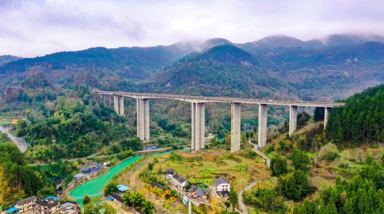
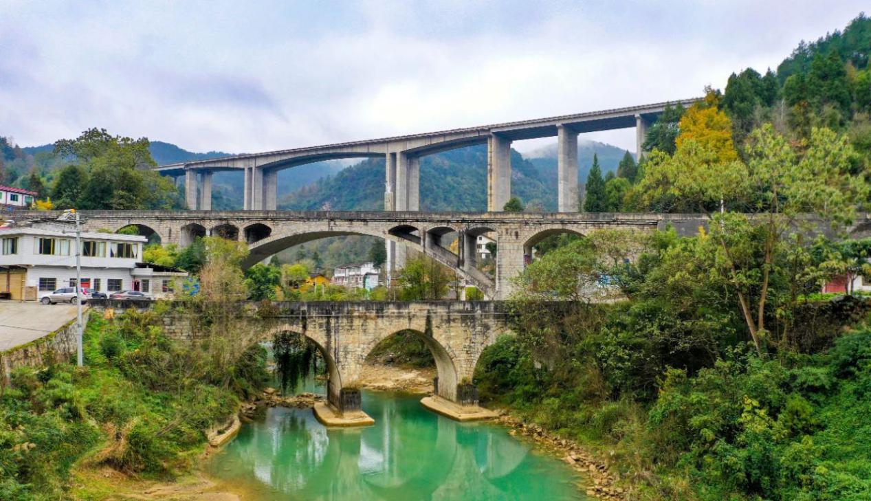
| − | One of many high beam bridges along the G56 expressway as it cuts across eastern Guizhou Province, the Maoguanhe Bridge G56 has a main span of 120 meters. | + | One of many high beam bridges along the G56 expressway as it cuts across eastern Guizhou Province, the Maoguanhe Bridge G56 has a main span of 120 meters. Just south of the G56 crossing are the older concrete arch bridge on local route G326 built in 2007 and an even older stone arch bridge that was last widened and strengthened in 1941. |
The G56 Hanggrui Expressway is one of China's epic 4-lane highways that extends 2,935 kilometers from the east coast city of Hangzhou all the way to the west coast city of Ruili at the border with the country of Burma. | The G56 Hanggrui Expressway is one of China's epic 4-lane highways that extends 2,935 kilometers from the east coast city of Hangzhou all the way to the west coast city of Ruili at the border with the country of Burma. | ||
| − | [[File: | + | [[File:Maoguanhe G56 Bridges.jpg|750px|center]] |
| − | [[File: | + | [[File:MaoguanheBridgesSatellite.jpg|750px|center]] |
| − | |||
| − | |||
| − | |||
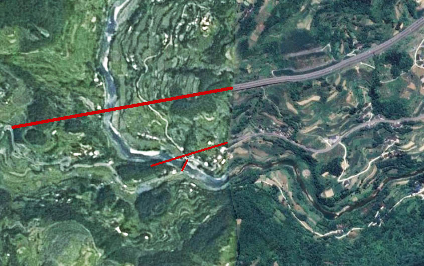
Maoguanhe Bridge G56 satellite image. | Maoguanhe Bridge G56 satellite image. | ||
| − | [[File: | + | [[File:Maoguanhe Bridge G56LocationMap.jpg|750px|center]] |
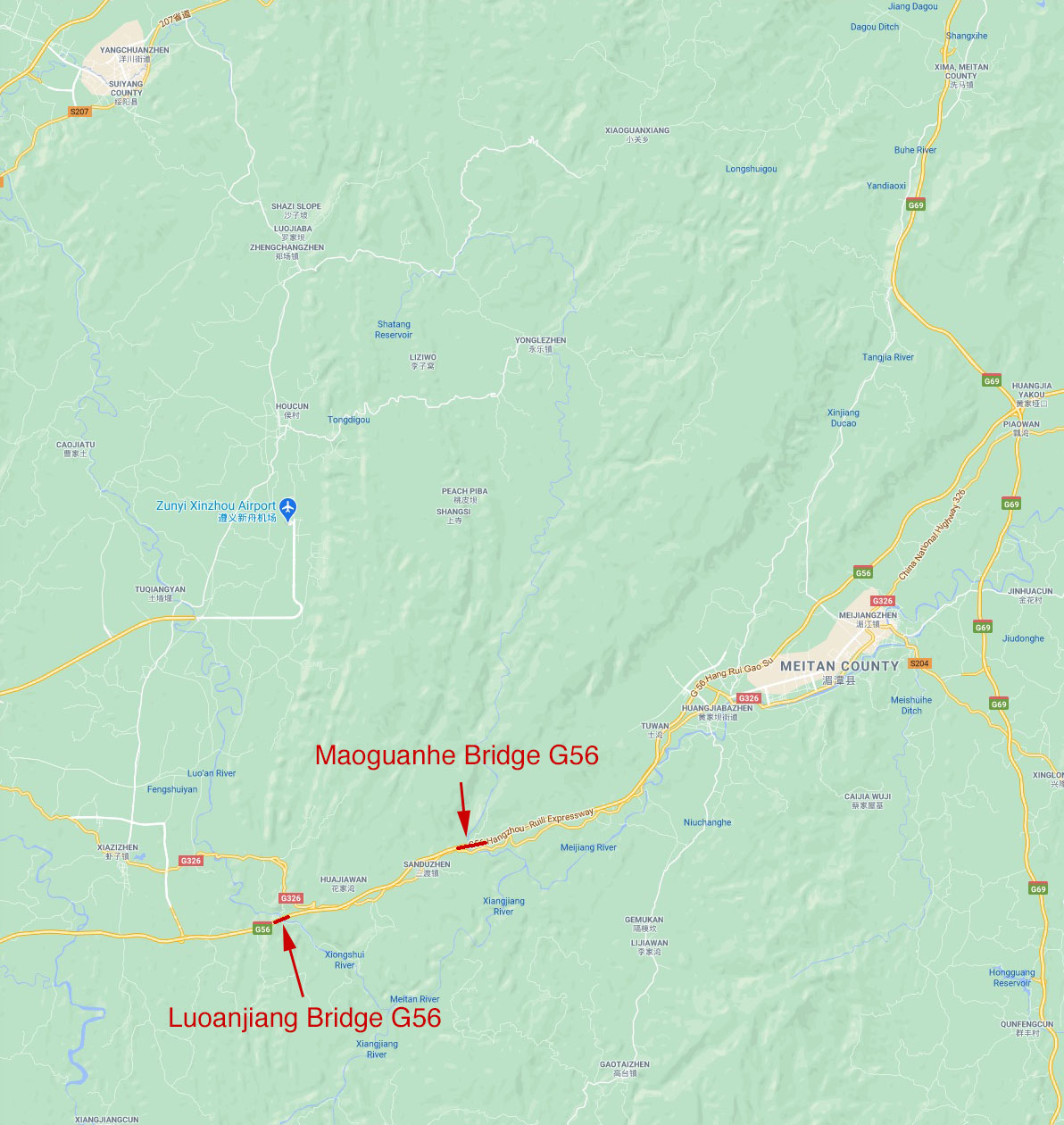
Maoguanhe Bridge G56 location map. | Maoguanhe Bridge G56 location map. | ||
[[Category:Bridges in China]] | [[Category:Bridges in China]] | ||
Latest revision as of 05:54, 4 February 2021
Maoguanhe Bridge G56
杭瑞高速茅官河大桥
Zunyi, Guizhou, China
(279) feet high / (85) meters high
394 foot span / 120 meter span
2013
One of many high beam bridges along the G56 expressway as it cuts across eastern Guizhou Province, the Maoguanhe Bridge G56 has a main span of 120 meters. Just south of the G56 crossing are the older concrete arch bridge on local route G326 built in 2007 and an even older stone arch bridge that was last widened and strengthened in 1941.
The G56 Hanggrui Expressway is one of China's epic 4-lane highways that extends 2,935 kilometers from the east coast city of Hangzhou all the way to the west coast city of Ruili at the border with the country of Burma.
Maoguanhe Bridge G56 satellite image.
Maoguanhe Bridge G56 location map.


