Difference between revisions of "Moyie River Bridge"
(Created page with '<div style="font-size: 25px; text-align: center;"> Moyie River Bridge<br /> Moyie Springs, Idaho, United States<br /> 464 feet high / 141 meters high<br /> 377 foot span / 115 me…') |
|||
| (5 intermediate revisions by the same user not shown) | |||
| Line 5: | Line 5: | ||
377 foot span / 115 meter span<br /> | 377 foot span / 115 meter span<br /> | ||
1964<br /> | 1964<br /> | ||
| − | [[File:2MoyieBridge.jpg| | + | [[File:2MoyieBridge.jpg|750px|center]] |
</div> | </div> | ||
| − | One of the highest deck truss bridges in the world, the Moyie River bridge is located just south of the Canadian border in the U.S. state of Idaho. Far less known than the Perrine bridge in Idaho Falls, the Moyie crossing is nearly as high at 464 feet (141 mtrs). Constructed in 1964, the current span bypassed more than a mile of twisting road that descended to the bottom of the canyon where it crossed a bridge built in 1923. The Moyie | + | One of the highest deck truss bridges in the world, the Moyie River bridge is located just south of the Canadian border in the U.S. state of Idaho. Far less known than the Perrine bridge in Idaho Falls, the Moyie crossing is nearly as high at 464 feet (141 mtrs). Constructed in 1964, the current span bypassed more than a mile of twisting road that descended to the bottom of the canyon where it crossed a bridge built in 1923. The Moyie River begins in British Columbia, Canada and flows into the Kootenai before meeting the Columbia River which empties into the Pacific Ocean. |
Supporting the 3-span truss are two concrete piers with 3 levels of varying thickness. The tallest of the two piers measures 217 feet (66 mtrs) from foundation to cap. The bridge measures 1,233 feet (373 mtrs) from end to end. On the east side of the bridge there is a parking area where you can walk out onto the bridge. The more adventurous can try to view the structure from a road that descends to the river from the west side. | Supporting the 3-span truss are two concrete piers with 3 levels of varying thickness. The tallest of the two piers measures 217 feet (66 mtrs) from foundation to cap. The bridge measures 1,233 feet (373 mtrs) from end to end. On the east side of the bridge there is a parking area where you can walk out onto the bridge. The more adventurous can try to view the structure from a road that descends to the river from the west side. | ||
| Line 15: | Line 15: | ||
<div style="text-align: center; font-size: 25px;"> | <div style="text-align: center; font-size: 25px;"> | ||
| − | [[File:MoyieElevComingSoon.jpg| | + | [[File:MoyieElevComingSoon.jpg|750px|center]]<br /> |
Moyie River Bridge Elevation<br /> | Moyie River Bridge Elevation<br /> | ||
</div> | </div> | ||
| − | [[File:1MoyieRiverBridge.jpg| | + | [[File:1MoyieRiverBridge.jpg|750px|center]] |
Image by Eric Sakowski / HighestBridges.com | Image by Eric Sakowski / HighestBridges.com | ||
| − | + | [[File:3MoyieBridge.jpg|750px|center]] | |
| − | |||
| − | |||
| − | |||
| − | |||
| − | |||
| − | |||
| − | |||
| − | |||
| − | |||
| − | [[File:3MoyieBridge.jpg| | ||
Image by Eric Sakowski / HighestBridges.com | Image by Eric Sakowski / HighestBridges.com | ||
| − | [[File:4MoyieBridge.jpg| | + | [[File:4MoyieBridge.jpg|750px|center]] |
Image by Eric Sakowski / HighestBridges.com | Image by Eric Sakowski / HighestBridges.com | ||
| − | [[File:5MoyieBridge.jpg| | + | [[File:5MoyieBridge.jpg|420px|center]] |
Image by Eric Sakowski / HighestBridges.com | Image by Eric Sakowski / HighestBridges.com | ||
| + | [[File:MoyieRiverAerial.jpg|750px|center]] | ||
| + | Moyie River Bridge satellite image. | ||
[[Category:Bridges in United States]] | [[Category:Bridges in United States]] | ||
| − | [[Category:Bridges in | + | [[Category:Bridges in Idaho, United States]] |
Latest revision as of 23:39, 8 January 2010
Moyie River Bridge
Moyie Springs, Idaho, United States
464 feet high / 141 meters high
377 foot span / 115 meter span
1964
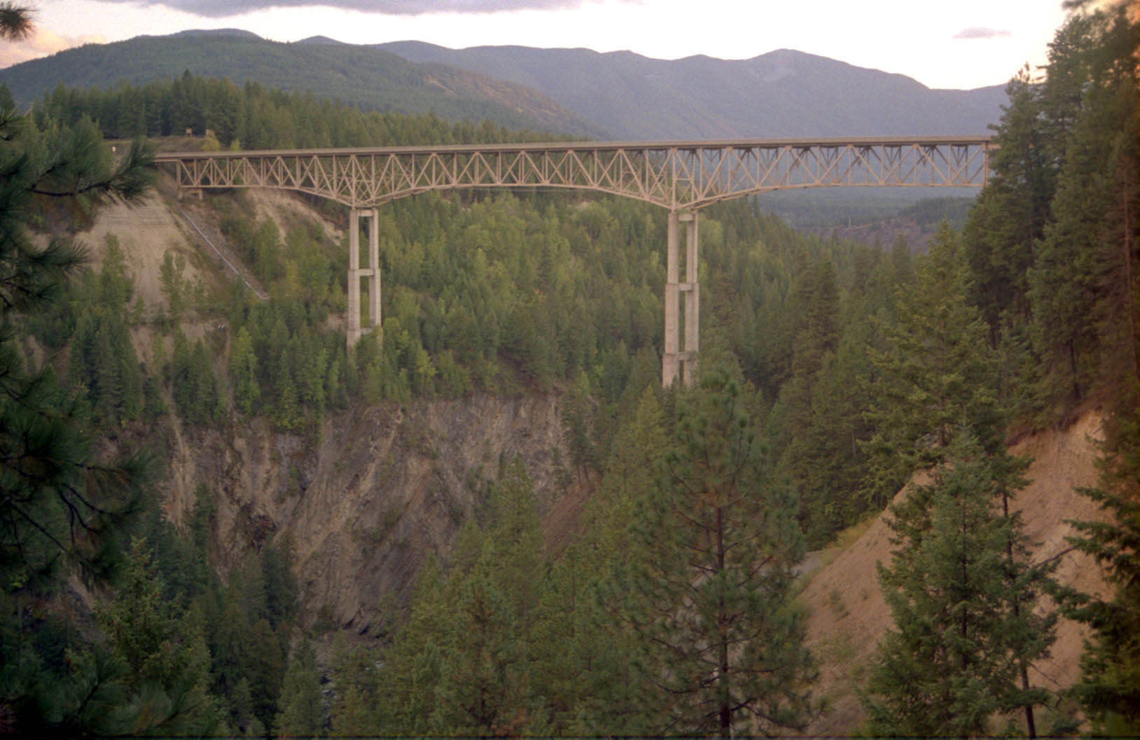
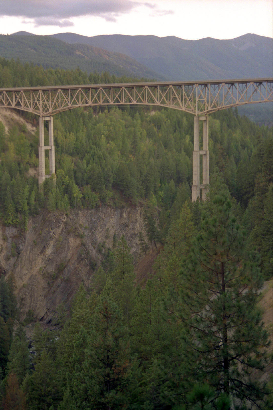
One of the highest deck truss bridges in the world, the Moyie River bridge is located just south of the Canadian border in the U.S. state of Idaho. Far less known than the Perrine bridge in Idaho Falls, the Moyie crossing is nearly as high at 464 feet (141 mtrs). Constructed in 1964, the current span bypassed more than a mile of twisting road that descended to the bottom of the canyon where it crossed a bridge built in 1923. The Moyie River begins in British Columbia, Canada and flows into the Kootenai before meeting the Columbia River which empties into the Pacific Ocean.
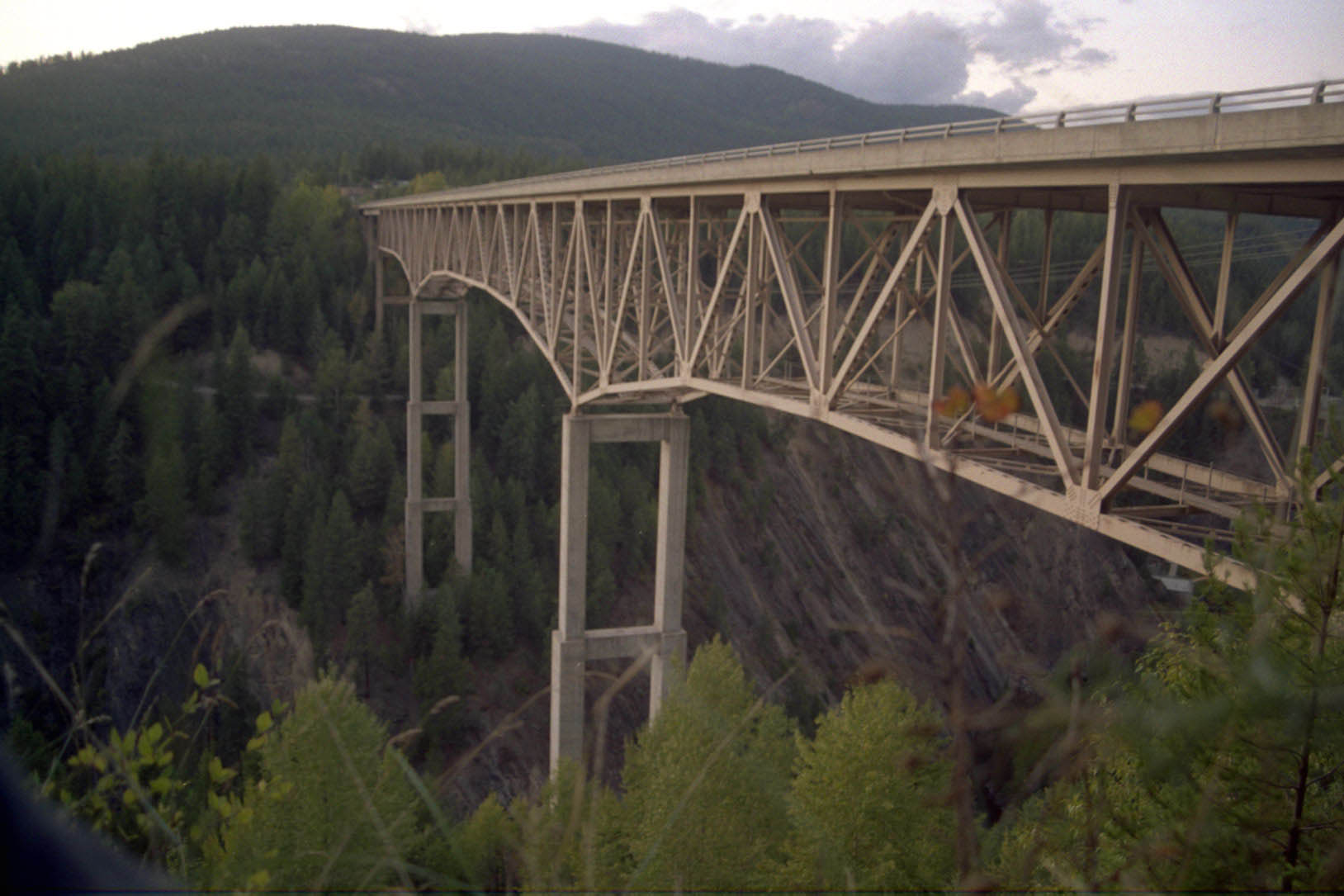
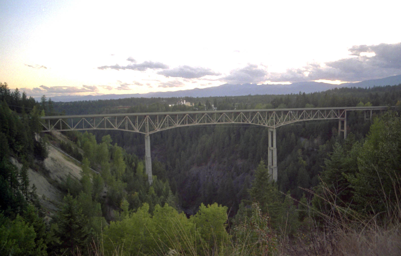
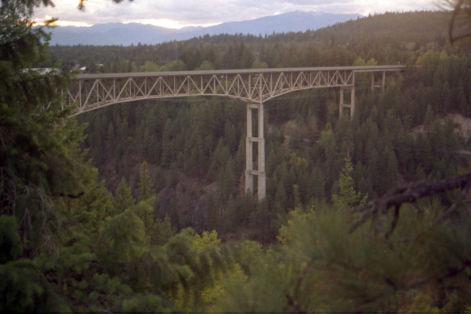
Supporting the 3-span truss are two concrete piers with 3 levels of varying thickness. The tallest of the two piers measures 217 feet (66 mtrs) from foundation to cap. The bridge measures 1,233 feet (373 mtrs) from end to end. On the east side of the bridge there is a parking area where you can walk out onto the bridge. The more adventurous can try to view the structure from a road that descends to the river from the west side.
Image by Eric Sakowski / HighestBridges.com
Image by Eric Sakowski / HighestBridges.com
Image by Eric Sakowski / HighestBridges.com
Image by Eric Sakowski / HighestBridges.com
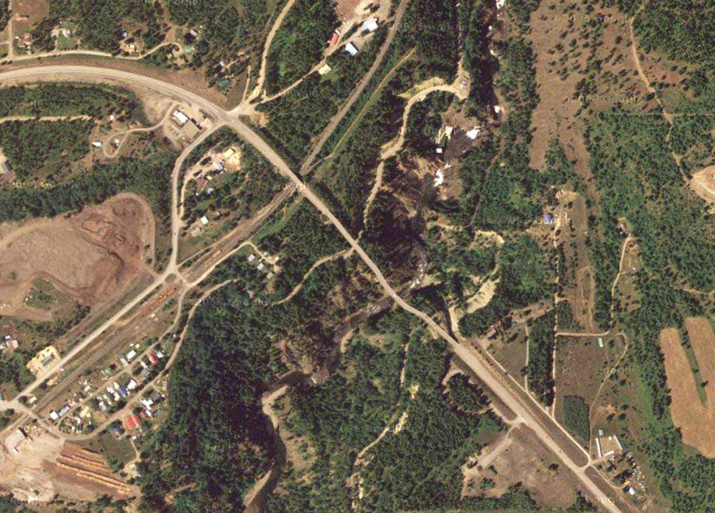
Moyie River Bridge satellite image.
