File:Spinne highline179.jpg
From HighestBridges.com
Jump to navigationJump to search
No higher resolution available.
Spinne_highline179.jpg (787 × 567 pixels, file size: 218 KB, MIME type: image/jpeg)
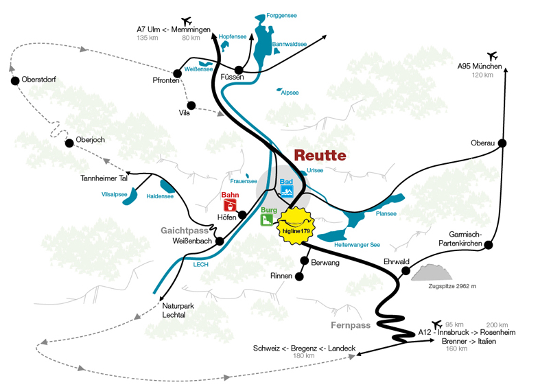
Highline 179 Footbridge location map.
File history
Click on a date/time to view the file as it appeared at that time.
| Date/Time | Thumbnail | Dimensions | User | Comment | |
|---|---|---|---|---|---|
| current | 20:37, 20 January 2017 | | 787 × 567 (218 KB) | Sakowski (talk | contribs) | Highline 179 Footbridge location map. |
You cannot overwrite this file.
File usage
The following page uses this file: